Meet Your Colleagues: GIS Team, USS Partner Consulting Services
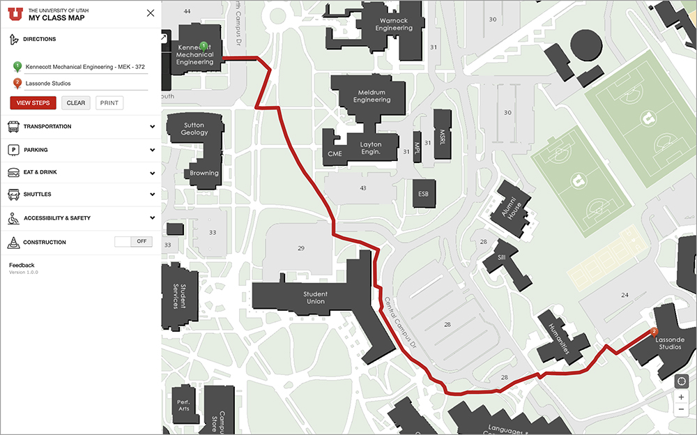
Students can use My Class Map to get directions from one class or building on campus to another.
In 2019, core geographic information system (GIS) development, system administration, and support moved from Facilities Management (FM) to UIT’s University Support Services. The decision to centralize GIS development in UIT reflected growing demands for GIS services at the university and relieved an unsustainable burden on FM’s financial and staffing resources.
“Facilities Management is still our top customer and a key funding partner, but we’re no longer focused only on GIS technologies around things like grounds maintenance and snow removal,” said Chris Strong, GIS system administrator.

L-R: Gary Carter, Chris Strong, Keegan Spencer, Shane Washburn, Jordan Ainslie, and Reza Sarijlou (not pictured: Ari Lacanienta).
FM’s GIS department still maintains the U’s building repository that includes drawings and floorplans, and a large catalog of datasets on buildings, sidewalks, roads, landscaping, and utility systems, many which are viewable on Campus Map. According to Shane Washburn, senior GIS software engineer, Campus Map remains the U’s most utilized GIS application, slightly ahead of the My Class Map wayfinding application.
Now part of USS Partner Consulting Services, a newly formed group that also contains a software development team dedicated to supporting the Northstar student management system, UIT’s GIS Team collaborates with an array of campus partners, including U Department of Public Safety, University Marketing & Communications, Commuter Services, and U Athletics.
Wayfinding (getting from point A to B) is one aspect of GIS work at the U. Mapping technologies can be indispensable on a circuitous 1,534-acre campus that includes 85 buildings. Finding the right building can turn into a Herculean task, not only for the U’s 35,000+ students, but faculty, staff, and contractors moving around campus every day as well.
A less-publicized component of geospatial technologies is physical security. The GIS Team recently embarked on a project to develop a security asset management (SAM) application to more comprehensively identify the location of security cameras and access-restricted doors on campus and the IT systems to which they’re connected. Keegan Spencer, a GIS associate software developer, said the app will detail every building on campus, floor by floor.
“GIS is a really powerful way to visualize information. Everyone can look at a map and instantly see what you’re trying to communicate. It’s impactful.”
– Chris Strong, GIS system administrator
Though artificial intelligence (AI) is an emerging field of study in GIS, the team noted promising developments.
For more than a year, the GIS Team has been busy upgrading Campus Map to a more modern software development kit (SDK). An SDK is a comprehensive collection of software-building tools like compilers that translate from one programming language to another, debuggers that help developers spot errors in their code, and code libraries that contain code sequences programmers use repeatedly. Washburn said Campus Map users are unlikely to notice any significant changes, but the upgraded SDK will feature enhancements like Java Speech API (JSAPI), an AI-based technology that incorporates speech technology into user interfaces.
Reza Sarijlou, manager for USS Partner Consulting Services, said the team is also piloting the use of CodiumAI, an integrated development environment (IDE) extension designed to help busy software developers with coding-related tasks throughout the software development life cycle (SDLC) process.
CodiumAI, Sarijlou said, will help build the majority of code for an interactive application to map out various details of Rice-Eccles Stadium, a project in early development. Funded by U Athletics, the first phase of the project focuses on building out an incident reporting tool. Spencer said phase two will involve more granular functionalities like identifying the location of season ticket holders and helping attendees navigate to their seats, around the concourse, and to individual vendors. Washburn noted this represents a challenge when you consider the competing bandwidth needs of 50,000 people densely packed into a relatively small space.

Machine learning has implications in GIS as well. Spencer noted a specific use case when he worked in Commuter Services prior to joining UIT in 2022. Spencer worked with Ian Hazel, a GIS analyst in Commuter Services, to build a tool designed to study the deterioration rates of parking lots on campus. A drone would capture arial imagery of parking lots, which would be run through an AI-based model that analyzed different degrees of damage.
“The tool quantified damage and informed decisions about what needed to be replaced,” Spencer said. “As you collected more historical data, you could compare year after year, to determine if a lot was degrading at a really fast rate and needed to be repaired right away, and whether it needed to be completely torn out and resurfaced or based on the deterioration rate, just retarred. … It’s a great example of how you can get value from data and imagery, and make more informed decisions.”
Washburn said GIS work has its challenges, like “translating concepts about static maps into more dynamic layers,” or data management, which he called “a huge job.” Spencer said certain tools like ESRI's ArcGIS Pro, while extremely robust, often need customization to work as needed.
Still, the team enjoys the variety of projects and finds the work fulfilling.
“GIS is a really powerful way to visualize information,” Strong said. “Everyone can look at a map and instantly see what you’re trying to communicate. It’s impactful.”
Node 4
Our monthly newsletter includes news from UIT and other campus/ University of Utah Health IT organizations, features about UIT employees, IT governance news, and various announcements and updates.